Outdoor enthusiasts are being warned by Avalanche Canada that the avalanche danger on B.C.’s south coast will be high over the next few days.
Flurries are continuing on Tuesday with an onshore flow persisting in the coastal ranges. There will be a break on Saturday before another low pushes into the area on Saturday night.
"A steady push of moisture into the B.C. south coast with soaring freezing levels will start on Sunday,” Avalanche Canada said on its website.
The stormy weather conditions have prompted the high danger rating on both Friday and Sunday. People are being advised to avoid avalanche terrain during periods of heavy loading from new snow and wind.
"Another 40 to 60 cm of new snow is expected by Friday afternoon, forming touchy and widespread storm slabs. This overlies firm wind-transported snow in lee terrain at upper elevations and moist, heavy snow or a melt-freeze crust on southerly slopes, especially at lower elevations,” said Avalanche Canada.
The likelihood of avalanches will increase with the arrival of the storm.
For areas around Garibaldi Provincial Park, there is uncertainty around how buried persistent weak layers will react to new loads.
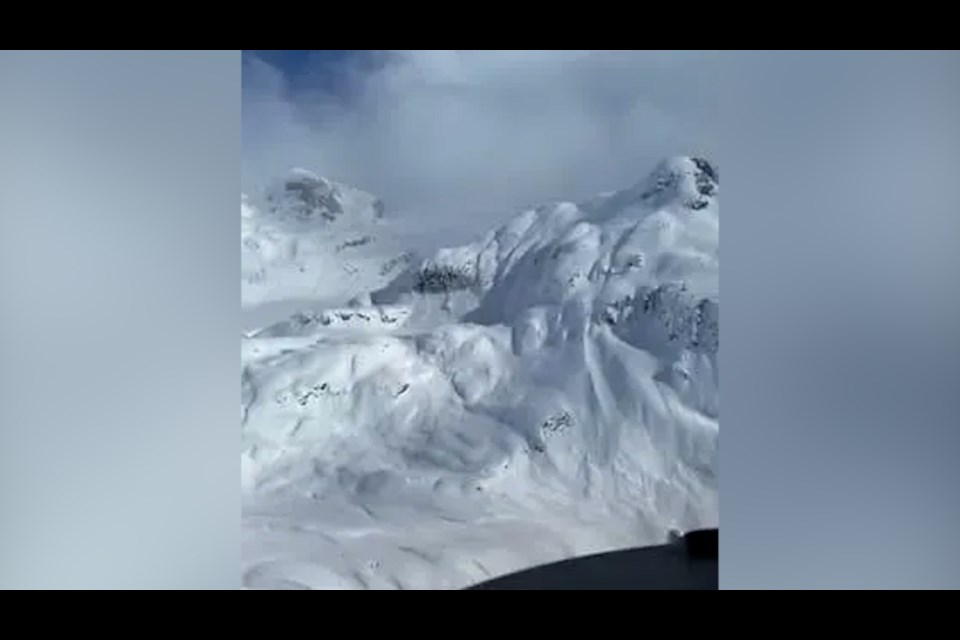
"Natural storm slabs were observed on northwest alpine slopes, suspected to have run overnight on Wednesday. Several dry loose [avalanches] were reported from steep terrain at treeline around Whistler,” said Avalanche Canada.
Avalanche activity will increase in this area as well during this stormy period and a natural cycle is expected.
Areas around Hope also have a high avalanche danger rating on Friday, which drops to considerable for the remainder of the weekend.
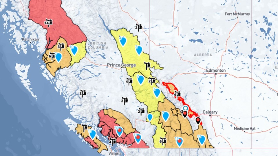
An Avalanche Canada map shows the danger rating at level four out of five across the coastal mountains and Sea to Sky area, including Squamish, Whistler and the Fraser Valley, as well as E.C. Manning Park. The danger is also ranked at level four in the mountains on the west coast of Vancouver Island and in the Stewart area on the north coast.
In the Kootenay region, the danger is ranked at level three or "considerable."
For more information about conditions, visit Avalanche Canada’s website.
Special avalanche warning for central Rockies
The monitoring agency has issued a public warning for the central Rockies saying there have been several large avalanches over the last two weeks.
It said two slides have been fatal and the snowpack "remains primed for human-triggering."
The warning covers Banff and Jasper national parks and the Kananaskis area in Alberta, as well as Yoho and Kootenay parks in B.C.
The agency said weak layers have been buried under up to 90 centimetres of snow dumped by recent storms, with more fresh snow on the way.
Natural avalanche activity is beginning to taper off, but it says the storm snow will perpetuate "an unstable and highly volatile situation."
The special public warning for the central Rockies notes avalanches may be triggered from a distance, and warming, sunny weather and storms increase the likelihood of a slide being triggered.
It says people heading into the backcountry should choose low-angle terrain without overhead hazards.
Snowfall warnings from Environment Canada area also in effect for B.C. along the Coquihalla Highway between Hope and Merritt and Highway 3 from Hope to Princeton.
The weather office says 20 to 30 centimetres of snow is expected in both areas before easing Friday night.
With files from Canadian Press


