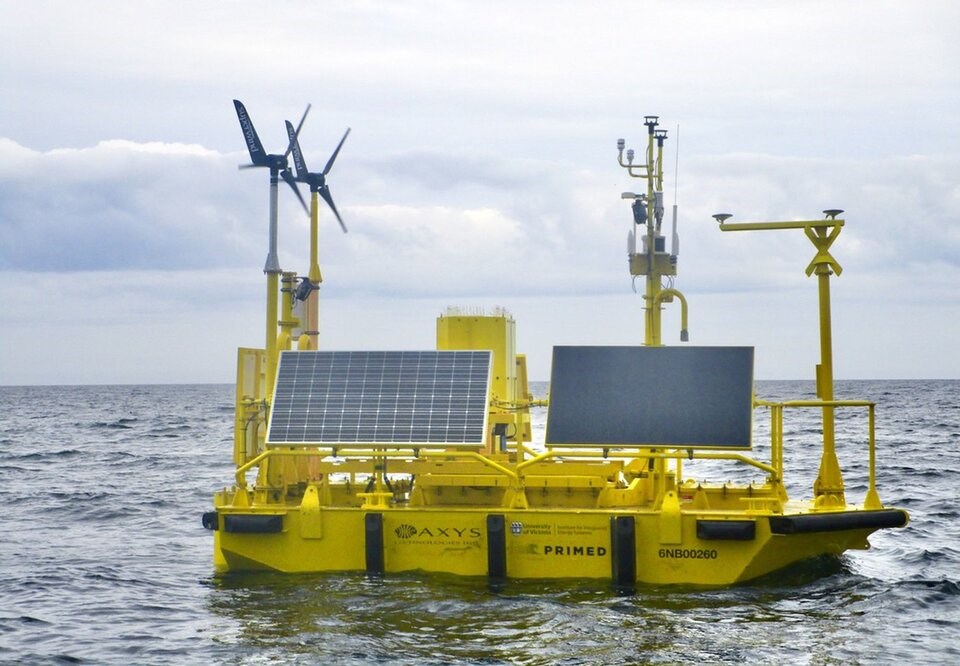
A yellow Floating Light Detection and Ranging (FLiDAR) Wind Sentinel buoy is anchored ten kilometres off G̲adsguusd North Beach in Haida Gwaii to collect data on wind, waves, and currents until September 2025.
The Council of the Haida Nation has collaborated with the University of Victoria's Pacific Regional Institute for Marine Energy Discovery (PRIMED) to research and characterize the abundant renewable energy resources available around Haida Gwaii. These include marine resources such as wave, tidal, and offshore wind power to reduce the island's heavy reliance on diesel.
Haida Gwaii comprises more than 200 small and large islands and is situated 100 kilometres west of the north coast of mainland B.C. Due to its isolated location, it is cut off from the primary BC Hydro power grid that serves the mainland.
PRIMED assessed that two diesel generation stations provide 60 percent of the power to the island's nearly 5,000 residents. More than 8.7 million litres of diesel fuel are used annually across the two sites to produce electricity. The north grid, including Old Massett, Masset, Port Clements, Tlell, Skidegate, Daajing Giids, and Sandspit, depends entirely on diesel for power.
They found Haida Gwaii's topography and geography make marine renewable energy abundantly available. Powerful tidal currents and winds provide predictability and consistency compared to onshore renewable sources.
The project aims to quantify these resources and identify feasible locations to harness sustainable energy. The collected data will be presented to the Council of the Haida Nation to help them make informed decisions about their energy systems.
"With support from the Council of the Haida Nation, we identified areas that avoid high cultural, socio-economic and environmental values while aligning with spatial management direction and long-term marine use objectives detailed in the Haida Gwaii Marine Plan," said Riley Richardson, PRIMED's project manager.
The Council of the Haida Nation will work with partners to determine the potential energy production, map the power grid, calculate diesel displacement, and estimate the cost of electricity generation.
Richardson says the project will not only conduct assessments, field work and modelling, but also research the theoretical impact of building these marine energy technologies around Haida Gwaii.
It will provide data that aligns with objectives of the 2015 Haida Gwaii Marine Planning Program to understand the meta-ocean conditions in Síigee G̲adsguusd McIntyre Bay. The parameters include wind speed and direction up to 200+ metres, atmospheric pressure, air temperature, relative humidity, solar radiation, directional wave measurements, current profile, water temperature, conductivity, and salinity.
Richardson emphasizes that PRIMED's goals are strictly research-based. The location at Síigee G̲adsguusd, North Beach does not represent the actual site of an energy production project.


